Velos Rotors successfully integrated the YellowScan Navigator LiDAR system on the Velos V3 during bathymetric surveying operations at Lake Ladonas, showcasing the platform’s compatibility with advanced hydrographic and topographic surveying payloads. During the deployment, the Velos V3 captured high-resolution bathymetric and terrain data, enabling efficient data acquisition across the surveyed area. The project highlighted the readiness and the growing role of UAV technology in bathymetric surveying, environmental monitoring, and geospatial mapping applications.
Velos V3 Conducts Bathymetric LiDAR Survey at Lake Ladonas
Recent Posts
- Velos Rotors Featured in Monocle’s “Shield of Achilles”
- Velos Rotors Announces Exclusive 25% Summer Offer on the Velos V3

- Velos Rotors Successfully Integrates Narda SignalShark on V-Twin
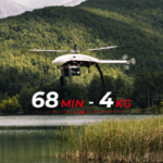
- Velos Rotors Breaks the Innovation Barrier with 68-Minute, 4kg Flight
- Velos Rotors Introduces the Velos V-Twin Tandem Helicopter